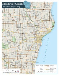
 The Wisconsin Department of Transportation's (WisDOT) county bike maps provide a bicycling conditions assessment that benefits both cyclists and transportation planners. Information about how to use the maps is available in the
detailed legend and description of the bicycling conditions. The county maps were updated in 2020 and based on the 2020 Wisconsin State Bicycle Map.
The Wisconsin Department of Transportation's (WisDOT) county bike maps provide a bicycling conditions assessment that benefits both cyclists and transportation planners. Information about how to use the maps is available in the
detailed legend and description of the bicycling conditions. The county maps were updated in 2020 and based on the 2020 Wisconsin State Bicycle Map.
The conditions for cycling represented on the map are intended for an average adult cyclist with at least some experience operating on higher speed roadways. For a regional or state perspective beyond county borders, the Wisconsin State Bicycle Map will be of greater benefit to you.
Click the desired county on the map below or choose from an
alphabetical county list.
Choose from an
alphabetical county list.
Many of the larger counties have been split in half to provide smaller files and more usable print copies. The PDF sizes vary from 6 MB to 11 MB.