
Photo Credit: Jeffrey Kratz
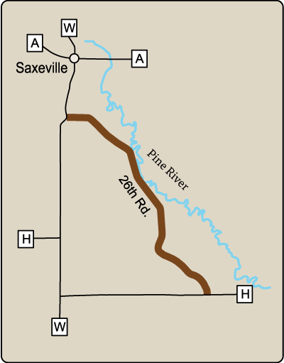
Location: Southeast Wisconsin, Waushara County. 26th Road, beginning at County H northwest to County W. This route connects with
R-117.
Length: 2.1 miles
Surface: Paved
This road curves among rolling hills, typical of the ground moraines found in Wisconsin’s central plains region. R-48 passes through the valley of the Pine River, a Class I trout stream. Much of the agricultural land and fallow fields found along this route support ring-necked pheasants, sandhill cranes, deer, red fox, beaver, otter and a wide variety of songbirds. A log cabin and two farmhouses, built before the Civil War on 160-acre Homestead Act grants, are visible from R-48.
View Rustic Road 48 in the Rustic Roads ArcGIS Online (AGO) Map.